Sunday, July 17, 2011

Annapolis to.....

There was no wind in the forecast for the foreseeable future and it was way past time to leave Maryland. This meant that our hard earned carbon credits would take a hit as we made our way to New York.

We headed up the Chesapeake with a pit stop on the Sassafras River, then continued on through the C and D Canal with another stop behind Reedy Island. Crossing the cut from Delaware Bay to the back side of Reedy Island is always a bit unnerving. It is very narrow with a wicked current smack dab on the beam. There is supposed to be plenty of depth, but we are always relieved to make it across without touching bottom.

The weather started to deteriorate just before arriving at the cut. It was another one of those afternoon thunderstorms that can be quite violent. A half an hour after we were anchored, 2 French boats (from France, not Canada) anchored fairly close to us. This was not a problem until the storm hit us with it's full force. Very strong winds against a five knot current meant all 3 of us were sailing around on our anchors. We all had our engines on as a precaution. The winds eventually died without incident. Then we got mucho inches of rain over the next couple of hours. The nice kind of rain with no wind and no lightening.


Taking advantage of "free" water to soap and scrub our Sporta Seats.

It would take a full day to make the Harbor of Refuge at Cape Henlopen at the south end of the Delaware Bay. We left about an hour before the current would turn in our favor. Going south, you can't ride a fair tide the whole way, so you try to at least get the full 3 1/2 hours that it gives you with the emphasis on the northern section where the currents are strongest. Going north we have been able to ride it longer. It's all about the tide actually being a wave blah blah blah.

As usual, once we neared Cape Henlopen, we decided to just keep going. By that time the tide had turned on us, so strategically it was not a great move, but we wanted to get the overnighter over with. It turned out to be a beautiful night, although it seemed we fought a foul current all the way to NY Harbor. We had not experienced a foul current on the New Jersey coast before, so I'm not sure what's up with that.

The other negative was we got bombarded with killer flies from Reedy Island all the way to Atlantic Highlands. We swatted and tossed full time. At one point I had a stare down with one and I watched him spit on his "hands" and then rub his eyes. We need to understand this behavior. I need stimulus money to study why flies wash their eyes with spit.

For any newbies out there, here's a couple of pointers. When you swat a fly and it appears to be dead, if there are no spilled guts, it is not dead. It is only stunned. Give it a few seconds or minutes and it will fly off. So you have to dispose of it immediately or he'll come back for seconds. On another subject...when you are at a Laundromat and you see all the out of order signs on the machines, it is really how the attendants save the machines for their side business. No more free advice.

As we approached Atlantic Highlands/NYC on a beautiful weekend day, New York Harbor was a buzz. One might get the impression that a lot of people live in the New York City area. I want some stimulus money to do a study--I can do several studies at once. Oh, I guess I need to belong to a union. In addition to the commercial shipping, everyone who lives in NYC owns a boat and anchors in the middle of channels. It really is quite an experience. Many high speed ferries, ships, tugs, sport fishers, commercial fishers, pleasure boats of all sizes vying for flounder--even with calm weather the harbor is rockin and rollin. It's like the first shot in pool, except the balls keep scattering.

They added new channel markers in the middle of the anchorage at Atlantic Highlands, so there is a bit less room to anchor, but at least they didn't add mooring balls. As I've said before, we love this stop. There are beautiful places to take long walks, pretty trees, and nice hills. They also have a laundry, propane, grocery store, and a very good farmers market on Fridays. Like many of the towns we pass through, businesses here are finding it hard to survive.

We basically motored the whole way from Annapolis to Atlantic Highlands, so I'm looking for a group that I can give a Green seminar to. I hear this will build our carbon credits back up at light speed. I can tell them we only use recycled paper towels, don't drive an SUV, don't use soap that works, don't use bottom paint that works, use gas that clogs up our dinghy engine, use environmentally friendly jerry jugs that only spill liquid when the cap is on tight causing the liquid (gas) to make it's way down our deck then topsides and then safely into the water. Not only will I accrue carbon credits, but people will bow down to me and know that I am good.


Walking trail. The first time I've ever owned black tennis shoes. Lisa tells me they look fine, then she laughs at me.


Lisa walks too.


View from the bridge overlooking the Shrewsbury River and the town of Highlands.

Late one afternoon, we had some unexpected strong winds blow through. We didn't have our instruments on, but the gusts were really high. Lisa turned the engine on as we realized we were dragging. We came within a boat length or so of dragging into another boat, but were able to motor out of trouble, weigh anchor, and then re-anchor in another spot. This alarmed us because we had set our anchor well, and it was our third day in the same spot. We take our anchoring process seriously and are not used to dragging, so it was quite humiliating. When I pulled the anchor up the area between the shank and the plow was full of big green leaves (that grow under water) which prevented it from resetting.

After observing the dynamics of the anchor and chain in the clear waters of the Bahamas (in my fish killing uniform), I'm convinced that the anchor resets every time the wind or current changes unless both are benign. The beauty of the plow type anchors (as opposed to say a Danforth or Fortress) is that they reset easily and well. The only thing I can figure is that when our anchor turned around it caught a mouthful of leafy growth which stopped it from resetting. I'm glad we were on the boat.

Friday we took advantage of the excellent Farmers Market, returned to the boat, then decided to go ahead and make our run through NYC, the East River and on to Manhasset Bay on Long Island Sound. The tide called for a late start--we needed to arrive at the Battery (Manhattan) somewhere between 4:15 and 5:15. This entails a foul current through NY Harbor then a fair current through Hell Gate and the East River.

As we passed under the Verrazano Bridge, we looked up at the cars above and marvelled at the voters that let the politicians charge them $10 a pop to creep across that bridge. Then we refocused our attention on the container ship and the tanker behind us. As you pass under the bridge you enter the Narrows--yes it narrows. Lots of ships are anchored here in addition to coming and going. A lot of high speed ferries are darting all around and numerous helicopters are taking off and landing . It's usually a bit rough because of the "narrowing" effect in addition to all the traffic, wind against current etc.

Once you exit the Buttermilk Channel and hang a right onto the East River, the turbulence dissipates somewhat. While there are still many high speed ferries to deal with, they can't come at you from as many different angles as they can in the harbor.

When you pass under the Brooklyn Bridge, the sleigh ride begins. After bashing up the harbor, the East River is fun--assuming you paid due attention to the tides. If not, you will have a bad day.

We rode the current all the way to Manhasset Bay and had the anchor down at 8:15--in time to watch the sun set.

We plan on being in the Fish Tail near the end of the month so that Lisa can take her HAM Radio license test. Yep. She wants to be a HAMMY. This will allow us to have free text email through our SSB when not in the US. More importantly, Lisa tells me she will be able to talk to the Space Station. I'm thinking she better learn Russian, Chinese, or Arabic if she wants to do that. In the mean time we're in the market for a good pocket protector.

Tuesday, July 5, 2011

Annapolis

We spent a lot longer in Annapolis than intended. As a matter of fact, we are still here. A doctor's appointment, waiting on results, then a follow up appointment coupled with waiting the arrival of materials needed for boat maintenance, just kept adding to our time in the area.
June brought July/August temperatures to us, the only problem being, we don't like July/August temperatures in the Chesapeake. We had hoped to be north a lot sooner, but that was not to be.


The train ride home to the marina. These are very young kids in their Optimists, being towed back after their time on the water.

A big project we have planned for this summer is to haul the boat out and to compound and wax the topsides (the area between the deck and the water), and to paint the bottom (boaters call this a bottom job. Also, if we refer to a dirty bottom, we are talking about a section on our boat that has marine growth on it). Our current plan is to do this at Chesapeake Boat Works in Deltaville since they have reasonable rates and allow you to do your own work. I would really like to get that done now, but we will probably wait until late summer/early fall when the temps are more agreeable.

The pumpout boats here normally make you give them your boat's documentation number, port of call, size of holding tank, length of boat, cell phone number etc. During one of our pumpouts while anchored in Weems Creek, the harbormaster's assistant (who drives the pumpout boat) asked for all that info, then handed us a sheet of paper from the harbor master on which he had written down our latitude and longitude. We were to fill out the remainder of the sheet of paper and take it to the harbormasters office at the city marina. They want to know our address, phone number, length of boat, last port, how long we plan to stay in our present spot, our next port, our next of kin, if we have any physical ailments, boat registration/documentation number, dinghy registration number, a photo ID (passport or drivers license). All of the above is NONE of their business. Somebody has to stop these people. OK, so they are trying to encourage people to pump out?

Reminds me of gun laws--only made for the honest people. Criminals don't care about laws and disregard them. When they get caught, the same people who want more gun laws fight to set the criminal free--making the gun laws an obstacle only for the law abiders. 1 + 1 = 2. 2 + 2 = 4. It's not rocket science.
We threw the sheet of paper away.

We almost made it 3 years before having a "security" issue on the boat. On July 5th at 4:15 am, Lisa, who had been reading in bed, opened the companionway in a not so quiet manner. Then I hear her talking to someone. It took me a moment to realize she was using her "I'm in charge, don't mess with me, you're in BIG trouble" teacher voice. As I made my way onto the deck, Lisa is demanding answers from 2 teenage boys (16-19 year olds) who are in the water next to an overturned kayak. They had been trying to board our boat from the kayak which had flipped over in the process. They shattered one of our cockpit anchor lights which was mounted on the rail near the cockpit. They either broke it so it wouldn't shine on them, or they accidentally hit it with the paddle when the kayak flipped over. Either way, we are minus one light.

Here's an example of the conversation.

LISA What are you doing on my boat?!!!! (said with emphasis and deep feeling)

Boy # 1 "I need a cell phone to call my mom" (said with a smooth, slick, and innocent tone). Then after an extended pause "Where's the closest shore?"

They had no chance of emptying the kayak, righting it, and getting in so they used it as a life jacket (one boy said he couldn't swim) as they made their way to the north shore (not very far at all--we were in a creek not an ocean),

I kept our million candle power spot light trained on them and Lisa kept her glare trained on them until we were sure they made it safely onto a pier and scrambled up the hill. Is it wrong to wish that they ran through poison ivy on their way up the brush to the road? OK, we didn't wish that, we only thought it might happen.

We think they stole the kayak from one of the waterfront houses and planned to rob our boat. They left one of those flashlights with the big honkin rectangle batteries on our deck.

For their benefit, Lisa yelled for me to call the police. We knew not to do that (once again--we're the ones that would be put through the wringer not the kids--been there done that). We decided that next time, I will yell for Lisa to get my shotgun.

The Skin Nazi is done, we have one more package to pickup tomorrow, 2 faxes to send, then we hope to be outta here. The plan is the Sassafras River, then the C and D Canal, down the Delaware perhaps to Henlopen Harbor then on north.

Friday, June 17, 2011

Back in The Ditch and Then Some

The Holiday weekend at the Cape Lookout Bight was like a water version of Times Square. Fascinating, but you wouldn't want it 24/7. Lots of fishing boats and water skiers buzzing around.

After leaving The Bight it was 81 miles to Belhaven and then another long day to the North River at ICW mile 60. Our last day on the ICW saw us through a very nasty and shoaling Currituck Sound with winds in the mid 20s, then 9 restricted bridges and a lock before settling down in Portsmouth at ICW mile 0. The channel in the Currituck Sound had enough depth, it just didn't always follow the markers with precision.

While anchored at mile 60, we were attacked by midges. We are talking plague proportions. As we entered the cockpit just after 5 am, it sounded like someone was running a chainsaw. It was well before sunup, but we had to don our sunglasses to have any chance to keep our eyes open without having midge pupils.

The term midge is somewhat generic, but we will call ours Martian Midges. That's because they secrete a green dye that will not wash off of gel coat. They are basically lazy mosquitoes without a needle to suck your blood. While a mosquito stands upright, these guys sort of rest on their bellies--like I said, lazy. Because they don't eat they only live a few days. They don't even care enough to try to escape certain death, they just lay there with a kill me sign on their back. Their duty is done already anyway--collectively, they've left green all over the boat with millions of smelly corpses.

They were inside our rolled up enclosure, on top of our cushions, under our cushions, the floor was completely covered, the bimini and dodger were covered, the dinghy was totally covered. We are talking millions.

Apparently they are males and they arrive in swarms. No duh. Next time we will anchor next to other boats with the hope of spreading them around more fairly--might even raft up. Naw.

With our sunglasses on and our mouths closed, we got underway as soon as was possible. While I helmed, Lisa spent 4 1/2 hours just to get the cockpit sort of clean. We threw the rolled up sections of our enclosure into the dinghy and would deal with them later. Sailboats can't afford much in the way of delays on this section of the ICW because of all the restricted bridges and the lock. At the end of the day one of the bridges stays closed for 2 hours for rush hour, so you don't want to be late.

When we arrived at Portsmouth, I dropped the dinghy in the water and took off with our rolled up sections of enclosure. It was like a Saturday Night Live skit. Me going in circles hoping no one is seeing the ten million midges swarming out of the dinghy while I bang on it to encourage their departure. It took me 2 hours to clean the inside of the dinghy and to rid the enclosure of midges. Lisa and I spent most of the following day cleaning the rest of the boat and the canvas. A couple of days of sun took the stain off the gel coat.

Lisa would rather go around Cape Hatteras, Cape Horn, and the Cape of Good Hope on consecutive days than to see another Martian Midge.

On Sunday, the Gay Pride bunch had their amps turned all the way up so that Norfolk, Portsmouth and surrounding areas would be sure to hear how proud they are.

Our next stop was Fishing Bay in Deltaville, Va. We spent a few very hot and humid days there with the temperatures approaching 100.


Deltaville was hit by a tornado on April 16th of this year, taking with it 28 homes and cutting this church in half. It also snapped off and uprooted many trees.

After leaving Deltaville, we anchored on the beautiful Mill Creek off of the Great Wicomico River, then anchored on St. Leonard's Creek 10 miles up the Patuxent River past Solomons. During the week the latter is quite beautiful and restful, but we arrived on a Saturday. Not just any Saturday, but Poker Run Saturday for Cigarette boats.

Unlike most sailors, I don't hate those guys. If they can afford the fuel, more power to them. I'm sure they've saved up their carbon credits.

I'm a bit surprised they are allowed their high speed thrills on narrow creeks teeming with water skiers and other innocents. It kind of feels like Russian Roulette except the gun has 5 bullets and only one blank.

While we were on Lake Texoma, a similar venue saw 2 boats collide when the hydraulic steering malfunctioned on one, causing it to T-bone the other boat, killing 2. These were pros with their semi trucks painted to match their hot rod boats.

We stayed one night at Solomons so that we could stop at Food Lion. The very convenient Woodburns grocery store is a casualty of the economy and out of business. They weren't part of the stimulus package.

The first half of our sail from Solomons to Annapolis was miserable. We were expecting light 5 knot winds and an easy motor trip against the tide. Instead it was 20 + on the nose. After making painful gains upwind, I needed to reef the genoa, but the furler jammed. We had to pull a U turn and run down wind to get it unjammed. When it's rough out, sailing down wind is sweet. Being a gentlemen has it's advantages. But by the time I got the furler unjammed we were below our start point at the mouth of the Patuxent. So we had to start all over.

The last half of the day, the winds died and the tide finally had mercy on us. We anchored in front of the Naval Academy and had a front row seat of several sailboat races. 


This is the wooden sailing vessel Bear. It's twin is called Bull.

After picking up a lot of supplies we had shipped to a mail service, we moved up the Severn River to Weems Creek which offers more protection. I get to see a skin doctor for the first time since leaving Texas. I'm so excited.

Sunday, May 29, 2011

Charleston to Cape Lookout


The Cruiser Babe is ready to go. Blue, pink, yellow, and orange do match, so long as you wear a man watch. Isn't she cute? 

At midnight, on the eve of our departure from Charleston, we changed our destination from Cape Lookout to the Poquoson River just inside the mouth of the Chesapeake. Our route would be just under 500 NM and take 4 days and 3 nights give or take. Rounding Hatteras and a Friday departure sounded like a good combination. The forecast looked good and we knew we could always bail out so long as we did it before passing Cape Lookout.

Friday morning we tried to listen to Chris Parker on the SSB one last time, but propagation was terrible as it had been all week, so we got no help from him. We checked Passage Weather and Sail Flow and the forecast still looked good, however hints of possible scattered squalls started to surface.

Prior to our departure, we had endured a couple of bouncy nights at anchor but it didn't get any better after weighing anchor. We waited until 9:30 am to up anchor to ensure a daytime arrival at the Chesapeake. We can run the ship channels in the Chesapeake at night, but the bay is infested with crab pots, so we prefer to have daylight.

With the wind against tide, leaving the Charleston Inlet was quite rough. We thought conditions would improve once we left the channel, but it turned out to be a rough passage. All the models predicted 2 to 4 foot seas but it was not to be.

We sailed until 3 the following morning with all 3 sails and the main slightly reefed. The wind was more from the east than was forecast, which put us on a close reach (wind forward of the beam) instead of a broad reach (wind aft of the beam) or a run (behind the boat). In our lake sailing days, I loved close reaching or close hauled sailing, but with 5 to 6 foot swells on the beam it's not so much fun.

At 3 the wind died, so it was motor sailing for the rest of the trip. With the swells on our beam we were like a Grandfather Clock sans cuckoo bird for the whole trip.

We enter our latitude and longitude into our log every hour on the hour like they did in the old days. That way, when the Chinese finally decide to shoot down our satellites, we have a reference to plot our position on our paper charts. It will also be helpful if lightning knocks out our GPSs.

Nightfall brought with it a spectacular view of the stars. It didn't take long before lightening started to chase us from behind, then on both sides, and eventually appeared in front of us as well. It was still clear above us with the stars as beautiful as ever. As I've said before, with our 57 foot mast, I'm mucho scardo of lightening, but it did not pounce on us.


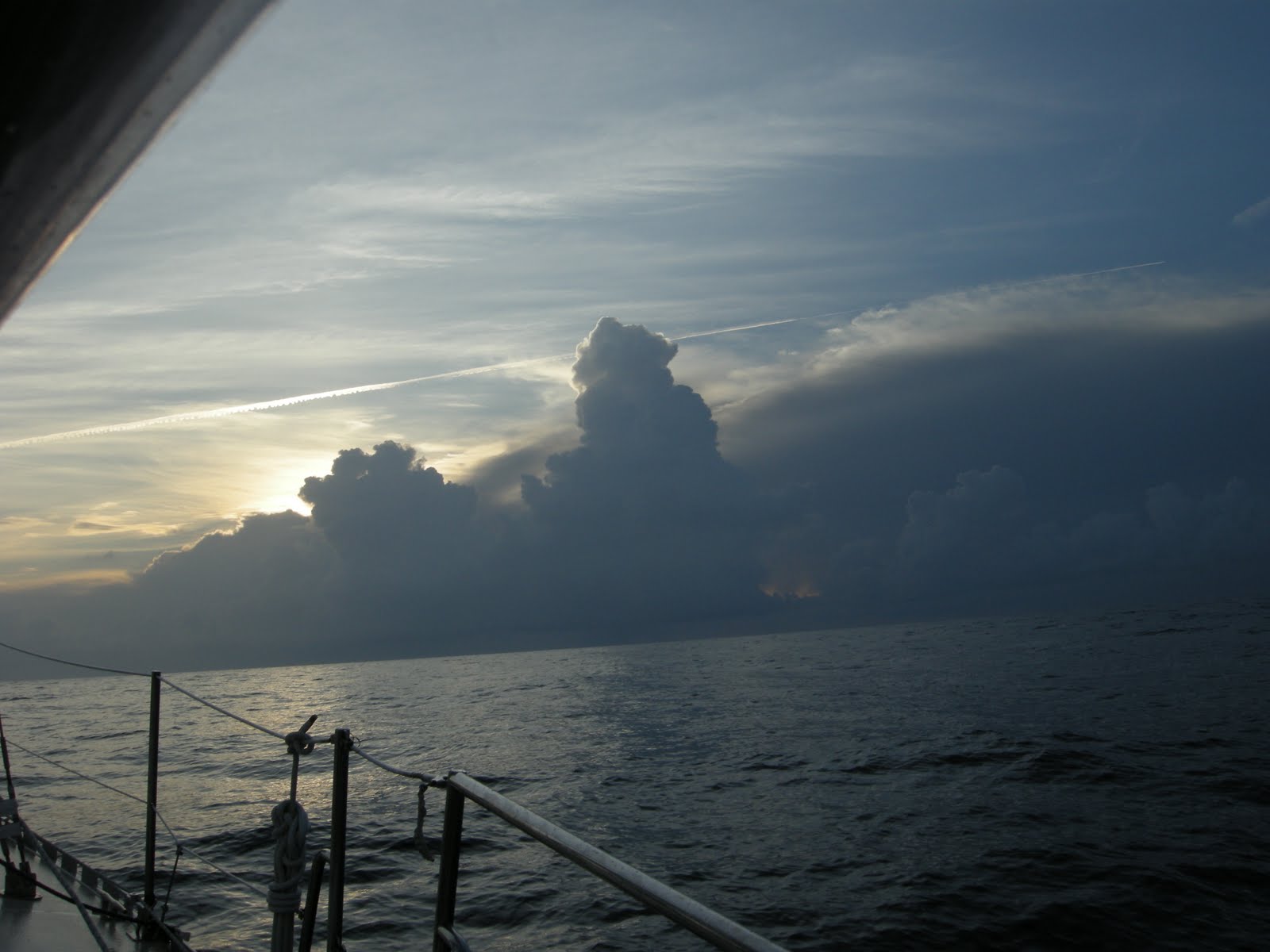
Sunrise exposed the clouds to our east that threatened all night.


A tad bit of instability.


We found some shade. Who needs a bimini?

After rocking and rolling all day and night, and with the unstable atmosphere, we easily convinced ourselves to not round Hatteras this time around. So, after checking weather again, we decided to alter course and head for Cape Lookout.


A little birdie told me... OK, what's with these birds? This guy did not die on us. He flew off after a couple hours of rest. We could not offer him water because it was too rough. The picture looks calm, but the swells were knocking us around pretty good. 

We had another one stay with us on our way from Ft. Pierce to Charleston. That trip was calm, and he bathed in the water we provided him, then flew off. Lisa thinks she can restore her baby bird sitting resume to good standing. Hard to do when one died on you though.
When we finally made it to our anchorage, our worst fears were realized---holiday weekend + nice anchorage + close to several cities = lots of boats. I know my consumer math. But it is a large anchorage, and our anchor was down at 11:30 pm.

Wednesday, May 25, 2011

Stuart to Charleston

Nasty wind and rain greeted us upon our arrival back at the marina. Our rental car was full of Costco purchases, so we were relieved that the rain let up just long enough for me to coax the marina manager to shuttle me to our boat so that I could retrieve our dingy. By the time I made it back to the dinghy dock it was raining again, so we killed several hours in town to give the weather a chance to move out. This made for a late night, but we were thankful that the rain finally did move on.

On Monday morning we dropped off a weathered Stars and Stripes at the local Ace Hardware store, returned the rental car, made one last stop at Publix, dropped the mooring line and headed for Fort Pierce.

The forecast called for a week of perfect trawler weather--beautiful with light winds. We wanted to go straight from Ft Pierce to Cape Lookout (which is just a few miles past the inlet at Beaufort, NC ) and in fact started out on that route, but then thought better of it and headed to Charleston, SC instead.

The problem was fuel. Our large tank was nearly empty and the smaller one was only half full (the last time we fueled up was early December in Daytona--how about that one stink potters. Remember that when you leave us in your wake).

Fuel prices vary widely on the East Coast now. Sometimes there's an 80 cent per gallon difference. Florida has recently added an extra 7 or 8 cent per gallon tax for pleasure boats, so we determined we would fuel up somewhere else since we could. That and the lack of wind in the forecast (no sailing) forced us to hang a left at Charleston.

The anchor was up at first light Wednesday and we had delightful weather throughout. The first night, the wind made an unexpected appearance for 8 hours and we enjoyed a lively 8-9 knot sail--with a little help from the Gulf Stream. At 2 am the wind died, but we picked up speed as we moved closer to the center of the stream. With the engine running at low rpms, we were doing 10 and 11 knots. The center of the GS is not in the same place everyday, so unless you have access to a forecast that gives you up to date latts and longs of it's current position, you are only guessing at it's speed and location.

Because we caught more of the stream than anticipated, we had to slow down our slow boat for the final 18 hours. We needed to keep our average speed at 5 1/2 knots or less for the remainder of the trip. This was so we didn't arrive at the Charleston Inlet before first light, although I won't worry about that in the future. It's a very easy inlet and channel. Plus, if you anchor when everyone else is asleep, you don't have to endure their "don't anchor too close to me" glares.

On our second afternoon out, we were in the process of making water (actually converting very salty water into delicious much much less salty water--the best tasting water there is, by the way) when Lisa reported the alarm on the watermaker was blinking. After a couple of attempts to restart it failed, Lisa noticed our bilge pump was spitting water out to the sea. After checking the engine room, I could see the leak was coming from somewhere behind the engine and stuffing box (where the prop shaft comes into the boat). Of course, that's where the main part of our watermaker is located, so it was time to empty the lazerette so that I could crawl down there and investigate. It was nice that the conditions were calm.

I assumed that a hose on the watermaker had burst open, but it ended up being the end cap to the tube that holds the membrane (where the high pressure pump blows the sea water and the membrane stops most of the salt, which is then flushed overboard). A chunk of the hard plastic had literally blown off the tube. After calling the watermaker company, they said there was a batch of bad end caps around the time ours was made, so they are shipping us 2 new end caps since the other side may be defective as well.


With the help of a mirror, you can see the hole where the high density plastic blew out. 

I don't think we were ever in any danger. The water stopped flowing when the watermaker shut down (and after we quit trying to restart it), but we shut the intake through hole, reloaded the lazarette, and continued on our way.


Lisa woke me from an afternoon nap to watch a large pod of dolphins playing off our bow. It was sunny and calm with clear water so it was a treat to watch them dart around. They made several appearances over the 2 days and nights we were out.


Now, that is calm water.


Steeple in Charleston.

While in the Charleston anchorage, we were reunited with fellow Texans Rick and Linda. It was good to see them again. They just sold their Catalina and purchased a catamaran. We got to be the first dinner guests on their new boat.

Day one at the city anchorage was uneventful. Day two was not. Charleston has a 6 foot tide, and the anchorage has a very strong current. In calm weather this is not a problem--the holding is very good. When the wind pipes up and goes across the current, it gets interesting. That's when boats start doing a white man dance--all out of sync.
In a normal anchorage, boats generally swing together--more or less. In anchorages with strong currents, skippers need to allow for more room. The total scope of your boat's rode and the rode of any boat around you plus maybe another million feet.

On our second day, a boat anchored too close to us, and then the wind piped up. We ended up fending them off several times. Turns out he had a fuel pump he was trying to fix. It became apparent that would not happen soon enough, so we weighed anchor, and moved a couple of miles south away from other boats.

We reanchored at the city a couple days later so that we could do laundry and pick up our watermaker parts, but then returned to our more secluded anchorage for the night.

We had the watermaker parts overnighted from California. Since we needed them pronto, they had us pay shipping, but not for the parts. After a day of bending every which way, and basically hurting all of my muscles and bones, the water maker is operational again--at least it passed a 6 minute test. We won't know for sure until we run it for a few hours.

When the weather settles, we will head to Cape Lookout. If the weather is nice, we may go around Hatteras and up into the Chesapeake.

Monday, May 9, 2011

Adios Bahamas

Marsh Harbor has by far the best grocery store we have seen anywhere in the Bahamas. It is very much like most grocery stores you would find in the US of A, except they are sorely lacking in the chocolate department. While the prices are higher than the US, they are much more reasonable than anywhere else we've been in the Bahamas.

While leaving Maxwells, we could see some pretty serious smoke coming from a nearby neighborhood. It turned out to be a tragic day for many, as 25 homes were lost to the fire.


A view of the smoke from the anchorage.


At 6:30 pm, we upped anchor and headed for Matt Lowes Cay. Lisa and I had spent a good part of this very warm day hiking around and past Marsh Harbor. We kind of over did it in the heat and we desperately wanted to swim to cool down. But it was well into shark dinner time so we settled on showers instead.


HEE HEE. For those of you from Rio Linda, that is signature Michael Jackson. Lisa claimed to be doing yoga on the beach, but sure looks more like MJ to me.


Yoga is so easy. Ummm.

After a couple of nights at Powell Cay we spent most of a day sailing to Double Breasted Cays. This is our favorite spot in the Abacos. It's far enough off the beaten path that it doesn't get too crowded. The guide books say the area is known for shark sightings (what area in the Bahamas isn't?). But if you can work up the nerve to jump in it is a great place to snorkel and spear fish. I finally got a grouper there.

Our plan was to make the jump to Florida from here, and my intent was to scrub the prop and clean the bottom one last time before our crossing. The only problem was that a 4 foot barracuda was hanging around under our boat. We were there for 3 days and so was he.

We have swum around a lot of barracudas, and generally they don't bother you. The books say most attacks involve spear fishing (why else would you snorkel?) or if they mistake shiny clothing or jewelry for a fish. Like a shark mistaking a surfboard for a seal. I love how they always say the animal didn't mean to do it. They don't get fat because they didn't mean to. They are predators. The books also say if you try to spear a barracuda or a shark they will attack you. Better not miss. That takes them off my target list.

Another thing the books say is that barracudas chop larger fish in half and then eat the pieces. So I didn't do a final scrub on the prop or bottom of our boat.

It was time to head back to Florida because we were out of chocolate. I was reduced to inhaling chocolate milk mix out of the packet (the only reason we had that was to mix it with an absolutely horrible vitamin mix we had to drink--only way I could get it down).

We left Double Breast Cays at 11 am on a Friday. We had a wonderful sail across the bank, first on a dead run with just the genoa, then with the wind just aft of a beam reach with all 3 sails up. The light wind was supposed to clock slowly from the east through south and then finally west (on the nose) right before arriving at the Ft. Pierce inlet. We are too yellow to enter St. Lucie Inlet--shifting bars and too shoal for our comfort.

For whatever reason, the banks have hazards on their edges, so you can't just exit wherever you want. We were originally going to exit at Mantanilla Shoals, but decided to go another 11 1/2 miles south to the White Sand Shoals to get a better wind angle for when we approached the Florida coast.


Near the edge of the bank. Our last Bahama sunset as we bid the turquoise waters adios.


30 seconds later.

We had a wonderful sail nearly all the way to Florida with all 3 sails up. The winds were supposed to be too light for sailing, but that was not the case. The big problem was they clocked to the west far sooner than forecast. This forced us to sail further north than we wanted. The Gulf Stream makes that a double whammy because it pushes you north really fast and thus further in the wrong direction. You can't tack south into the stream unless you like hove to speed. So we ended up almost 20 miles north of Ft. Pierce at which point I had hoped we would be out of the Gulf Stream and could tack back southwest for a normal sail. By that time we were still in the stream and about to run into thunderstorms to the north, so we went ahead and tacked to the southwest. We don't like hove to speed so we turned on the motor and motorsailed due west straight into the wind until we got out of the river. Then we were able to turn southwest and head for the inlet. The water temp in the stream was 81 degrees, and it was 72 degrees when we got out of it near the coast.

It would have been faster and easier to motorsail as soon as the wind went west and just do the rhumb line, but we really wanted to sail the whole way. Then we got tired and I really missed my chocolate.

This is the sixth time we've crossed the Gulf Stream, and we've gone a different route each time. None of them are my favorite. I would just as soon have a Jeanie blink us back and forth. I do prefer crossing in the daytime.
After entering the inlet at Ft. Pierce, we headed south on the ICW another 30 miles or so to Stuart where we will leave the boat for a few days to visit Mom and Carol.

Hopetown

We had a good time sailing in the Abacos. To the east, you have several cays which protect you from the swells, waves and the long fetch of the Atlantic Ocean. It can get a bit squirrelly in between the cays, but no big deal. To the west you have Great Abaco and Little Abaco to keep the waters from that direction quiet. So for the most part, it's like sailing on a big lake with the benefit of the wind and protection from the waves.

To get from the Central Abacos to the Southern Abacos (no great distance involved) you have to go outside into the Atlantic, get around Whale Cay, and then reenter just north of Great Guana Cay. Everyone freaks out about this section. Basically, the very deep Atlantic suddenly becomes relatively shallow near Whale Cay. When the waves and swells hit this shelf big rollers develop. Even if the wind is calm locally, this area can become untenable (the locals call it a rage). With the very long fetch, this area can suffer the affects of storms from a couple thousand miles away. We passed through this area in nice weather 3 or 4 times with no problems, but it was always a bit sloppy.


A fuel barge at Orchid Bay Marina on Great Guana Cay.


The Queens Highway in Hopetown.


My queen on The Queens Highway on Man of War Cay.


Back at Hope Town, Lisa nearing the intersection of Lady Di Blvd and Prince Phillip Ave.


The famous Hopetown Lighthouse.